Are We Seeing a New Ocean Starting to Form in Africa?
- Get link
- X
- Other Apps
Although shallow magma storage at Erta Ale volcano hints at a rift-to-ridge transition, the tectonic future of the Afar region is far from certain.

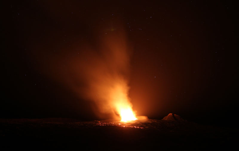
Standing next to a lava lake at the summit of a massive volcano, Christopher Moore, a Ph.D. candidate at the School of Earth and Environment at the University of Leeds in the United Kingdom, could see the red haze of lava flows a few kilometers away. This might seem like a rare sight, but at Ethiopia’s Erta Ale, it’s business as usual.
Are such behaviors the first signs of a tectonic transition? This question is part of what Moore has been studying at Erta Ale. The entire Afar region in eastern Africa finds itself in the middle of changes that could split the continent, forming a new ocean basin. The magmatism at Erta Ale might be offering signs of this switch by mimicking the characteristics of a mid-ocean ridge.

However, there isn’t agreement about how close the Afar region is to this tectonic transition. The geophysical characteristics of magma storage at Erta Ale could point to the region’s conversion to an incipient oceanic spreading center, but the petrology of the erupting lava might be telling us that we aren’t there yet.
What we will be able to see standing on top of Erta Ale will change dramatically in 5 million, 50 million, or 100 million years. The question is whether Erta Ale and the Afar region will become a new ocean, or whether ongoing tectonic collisions to Africa’s north and east will prevent this transition from occurring.
The Complex Tectonics of Eastern Africa
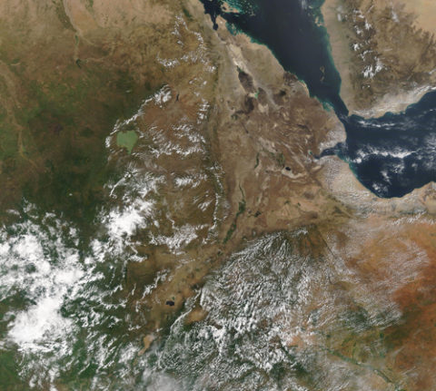
Few places on Earth remind people of the surface of the Moon more than the Afar region. Pressed against the Red Sea, this dry and desolate section of eastern Africa is covered in lava formed from the rifting of the continent.
The Afar region is home to a triple junction at the boundaries of three tectonic plates: the Nubian, Somali, and Arabian. They all meet near Djibouti and Eritrea, forming a massive Y on the Earth’s surface. The Great Rift Valley opens to the south, reaching over 6,000 kilometers into the heart of Africa. The Red Sea Rift extends to the northwest until it meets the Sinai Peninsula. To the east stretches the Aden Ridge, an oceanic spreading ridge. All of these boundaries are spreading at rates of up to 1.5 centimeters per year.
This tectonic complexity means that Africa is a continent tearing itself apart. For 30 million years, part of eastern Africa, known as the Somali plate, has been peeling away from the rest of the continent. This has created the Great Rift Valley, which starts in Ethiopia and Eritrea and splits around the Kenya Dome until recombining in the Malawi Rift. On a map, you can trace the rifting continent by looking at the chain of lakes like Tanganyika and Nyasa (Malawi) that line the bottom of the Great Rift Valley.
At the same time, the Arabian plate has been moving away from Africa as the Red Sea Rift opens at a rate of around a centimeter per year. Someday the Arabian plate will stop moving as it collides with the Eurasian plate in what is now Iran, closing the Persian Gulf and becoming part of Eurasia.
The Afar region’s tectonic complexity has created some of the largest volcanoes on Earth. This volcanism is bimodal, meaning eruptions lie on the ends of the compositional spectrum. Vast lava flows of basalt intermingle with massive explosive eruptions of lava more silica rich. These volcanoes line the Great Rift Valley.
To the north, massive basaltic shield volcanoes like Erta Ale lie near the Red Sea. Traveling south, you run into Ethiopia’s massive Corbetti Caldera, one of the most potentially dangerous volcanoes on the planet. Farther into Africa, you find oddities like the carbonatite-spewing Ol Doinyo Lengai in Tanzania to the east and the Democratic Republic of the Congo’s massive twin volcanoes of Nyamuragira and Nyiragongo to the west. All of these volcanoes reveal the active rifting beneath eastern Africa.
What Drives a Continent to Split?
Why is this area such a hub for rifting and spreading? One explanation is that the Afar plume has been heating the region from below. This mantle plume prompted the African continent to begin to rise and split, creating rift valleys. Much like how the North Atlantic Ocean opened 80 million years ago, there appears to be a close connection between a large mantle plume and the creation of new continental rifts and, eventually, two passive (continental) margins separated by seafloor spreading at ocean ridges.
Geologists have long been able to identify different tectonic settings and plate boundaries. Extensional (divergent), collisional, and transform boundaries have been recognized for decades. How one boundary turns into another is less well understood. When does subduction start at a passive margin? What happens when a spreading center gets sucked into a subduction zone? When does the rifting of a continent finally create a new ocean basin? These questions are hard to answer because we have limited modern examples of these transitional phases of tectonics.How can we recognize the point at which a rifting continent becomes a new ocean basin? All continental rifts are not the same, and some rifts fail, never producing true oceanic spreading. The Midcontinent Rift, for instance, was the site of an attempt to split North America about 1.1 billion years ago, but it failed. The mere observation of continental rifting does not mean that we are heading toward a new ocean.
The Afar region, at the nexus of tectonic plate boundaries, may be in the process of undergoing the transition from continental rift to oceanic spreading ridge. One way to approach the question of this transition is to examine the region’s crust. Instead of the 35-kilometer thickness that is typical for continental crust, the crust under Afar might be less than 20 kilometers thick. This includes layers of volcanic basalt that have spilled out over the area for millions of years.
Erta Ale: Afar’s Monster Volcano
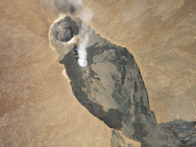
Another way to approach the question of the possible transition from continental rift to oceanic spreading in Afar is to look at the region’s volcanoes. Erta Ale, in northwestern Ethiopia, is one of the most active volcanoes on Earth. The massive shield volcano stretches 50 kilometers across, is almost 100 kilometers long, and rises 600 meters from the Danakil Depression.

By most accounts, Erta Ale has been erupting constantly for over 50 years, producing lava flows that stretch far down its slopes. It is also a member of a very exclusive club of volcanoes that are home to active lava lakes. In fact, only two volcanoes in the past quarter century have hosted multiple lava lakes simultaneously: Erta Ale and Kīlauea. As of March 2020, there is one active lava lake in the summit caldera of Erta Ale, and it is potentially one of the longest-lived lava lakes in the world, first observed in 1906.

Erta Ale is not the easiest place at which to conduct fieldwork. Before 2010, the trek to the summit was long and hazardous. Today the summit area near the lava lake is accessible by a tarmac highway. This has meant that tourists can easily visit the lava lake, but not without risks from both the volcano and outside violence. In 2012 and 2017, tourists visiting Erta Ale were killed by gunmen, sending chills down the spines of many who visit the volcano regularly.
Analyzing Magma Storage
By pure coincidence, Erta Ale erupted 6 months into Christopher Moore’s Ph.D. research on magma storage in the East African Rift. “Science changes very quickly, so you follow the exciting things,” said Moore.
The eruption prompted a question among volcanologists: Is Erta Ale more like a rift volcano or an emergent mid-ocean ridge volcano? Moore and his collaborators have been attempting to answer just that question to understand how magma is stored under Erta Ale. In his 2019 paper in Geochemistry, Geophysics, Geosystems, Moore laid out data showing that Erta Ale shares characteristics of a fast spreading mid-ocean ridge like the East Pacific Rise (EPR). Magma is stored in shallow bodies just underneath the EPR, a characteristic typical for mid-ocean ridges. If the Afar region is an incipient oceanic spreading center, how would magma storage at Erta Ale compare?
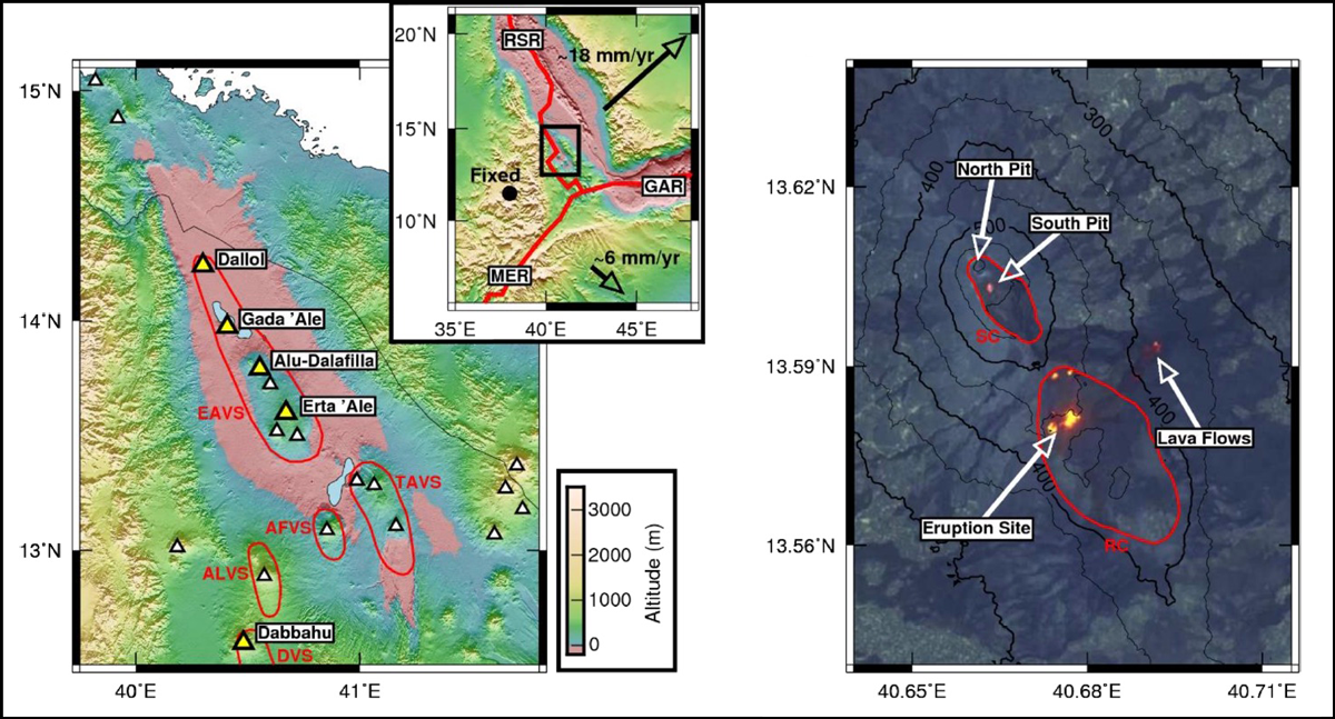
Moore and his collaborators used Sentinel-1 synthetic aperture radar data to unravel how Erta Ale physically changed during the course of an eruption that began in January 2017. Using the Sentinel-1 data, Moore modeled the deformation at Erta Ale as shallow intrusions under the volcano’s summit and under the site of a fissure eruption on its southwestern slopes.
“The contraction that we see [at the summit] combined with opening of the new dike [on the slopes]…was pretty much symmetrical,” said Moore. This meant that magma was moving from the summit to the fissure and responding quickly to changes in the shallow magmatic system under the volcano.
Beyond this deformation, Moore and his collaborators were able to use the level of the lava lake at Erta Ale’s summit as a gauge for the pressure state in the magmatic system under the volcano. During periods prior to the fissure eruption, the level of the lava lake remained relatively constant according to Sentinel-1 data as well as to observations from tourists and scientists visiting the volcano. However, once the January 2017 eruption event started, the lava lake level dropped precipitously. This meant the level was very sensitive to the pressure state of the magma stored under the volcano, dropping as pressure was released during the new fissure eruption. The new eruption down the slopes of the volcano prompted the summit lava lake to drain rapidly.
On the basis of both the lava lake levels and the geophysical models, Moore and his colleagues think that there are stacks of shallow magma bodies under Erta Ale, all within kilometers of the surface. Thus, Erta Ale is much like the EPR, where shallow magma bodies lurk beneath the mid-ocean ridge.
Is It or Isn’t It?
Does this mean that Erta Ale is in that transition phase from a rift volcano to a mid-ocean ridge? Tyrone Rooney of the Department of Earth and Environmental Science at Michigan State University in East Lansing argues that it might be more complicated than that.
“If it looks like a duck and quacks like a duck, is it a duck? Maybe not,” said Rooney. There is no agreed-upon definition for what constitutes a transition from one tectonic setting to another in this situation. Rooney has studied the East African Rift for years and recently published a study in Lithos that tackles the evolution of magmatism in the area.
Rooney agrees that the Afar region is clearly in the advanced stages of continental rifting but doesn’t know whether the rifting is a direct precursor to oceanic spreading. The sources of melting under the Afar region caused by the Afar plume look to be different than one might expect at a newly forming mid-ocean ridge.
And even though the crust is thin in the Afar region, it is not clear whether the lithospheric mantle under the crust has thinned as well. On top of that, the rifting in the region of Erta Ale is propagating northward as opposed to southward, as would be expected if the Red Sea Rift were driving the extension. Even so, the Afar region still might be the closest current relative we have to a new oceanic spreading center.

What Is the Transition?
Right now, Moore agrees that Erta Ale is still in a transitional phase. The question becomes what the Afar region will look like in 5 million years. He said the transition to an oceanic spreading center will be recognizable when the region develops the typically dense, 7-kilometer-thick igneous oceanic crust. The presence of shallow magma bodies under the active parts of the rift will be another clue. A further sign will be the development of telltale “magnetic stripes” on both sides of the boundary, as lava erupts and captures the state of Earth’s magnetic field. In all cases, the switch to an oceanic spreading center will be gradual.So far, it seems that Erta Ale is showing at least one of those signs: shallow magma storage. However, as Rooney has pointed out, we haven’t seen any development of true oceanic crust in the Afar region. All the petrologic evidence so far still points to the Afar plume as the source of the basalt erupting at Erta Ale. To him, this means that although the processes going on at Erta Ale and at a mid-ocean ridge look similar, they might be controlled by different tectonic processes.
Africa’s Future
The future of tectonics in the Afar region is unclear. It is far from agreed upon when, if ever, the region will become an oceanic spreading center or whether an ocean basin will form between the Somali and Nubian plates and how spreading in the Red Sea and the Gulf of Aden will progress. In one model, Christopher Scotese’s “future world” tectonic map suggests that 50 million years from now, the Red Sea and the Gulf of Aden will be gone as the Somali and Nubian plates slam into Arabia, suturing today’s three plates together.
The eruption at Erta Ale continues today. Moore’s research has shown that the volcano’s magmatic plumbing is a close continental analogue to the mid-ocean ridge magmatism in the East Pacific Rise. The question remains whether that similarity is a sign of things to come.
—Erik Klemetti (@eruptionsblog), Science Writer and Associate Professor of Geosciences, Denison University, Granville, Ohio
Except where otherwise noted, images are subject to copyright. Any reuse without express permission from the copyright owner is prohibited.
Comments
Post a Comment